Wind
Periodic winds during hurricanes and tropical storms are the most damaging of all hazards the territory experiences, causing more loss of life and property than that caused by coastal flooding.
Wind Hazards in the U.S. Virgin Islands
• Periodic winds during hurricanes and tropical storms are the most damaging of all hazards the territory experiences, causing more loss of life and property than that caused by coastal flooding.
• During tropical storms (39-73 mph) wind speed up means wind speeds can easily reach hurricane strength.
• Over the past 30 years ~30 high wind events hit the Territory, 13 category rated hurricanes including 2 category 5 events with windspeeds >157 mph.
• As per the 2019 US Virgin Islands Code Title 29 - Public Planning and Development Chapter 5 - Building Code, a basic wind speed of 145 mph is the minimum standard for the entire territory of the USVI. For most structures wind speed up has not been properly taken into account during design and lack of structural details impairs proper assessment of the wind hazard.
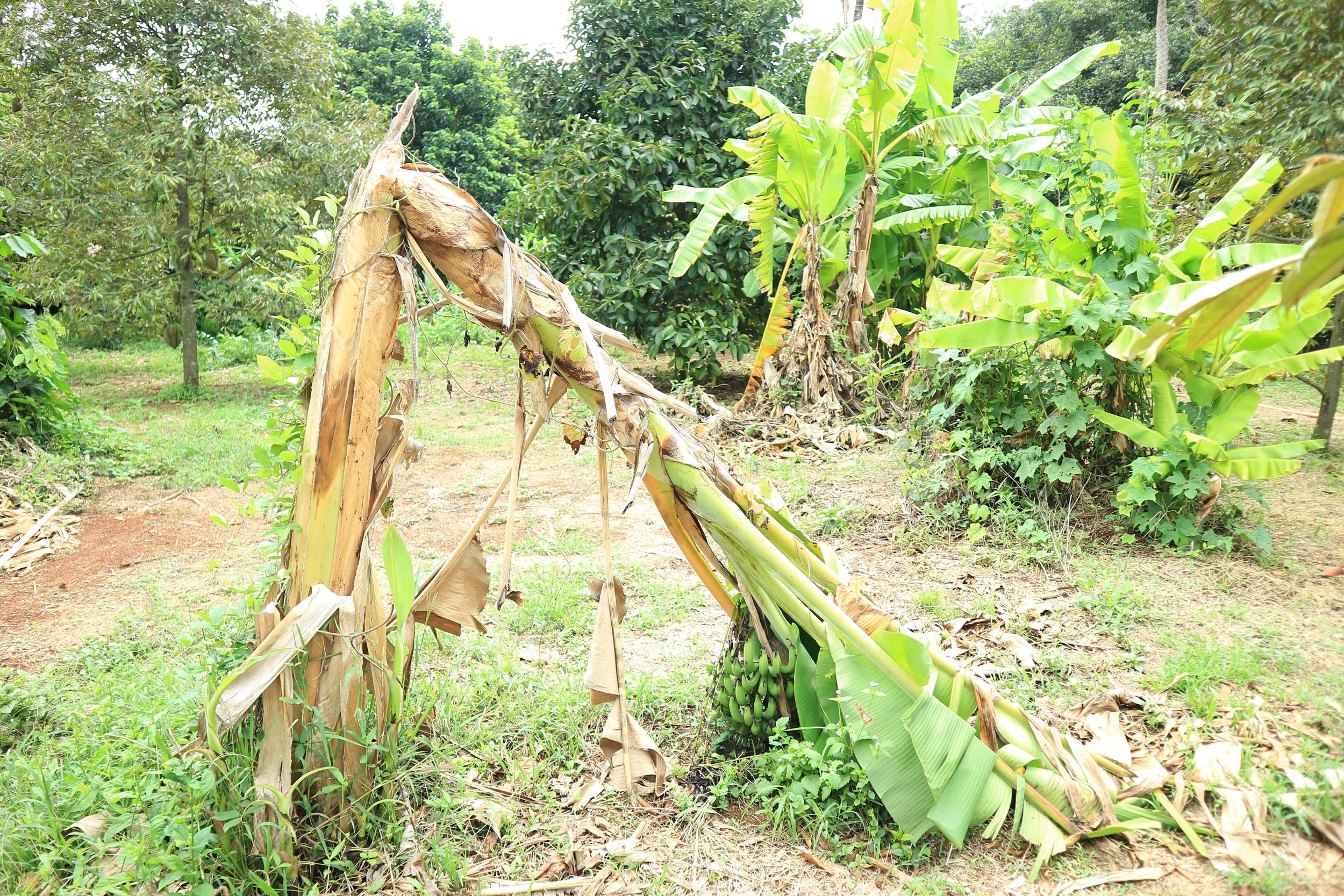
Wind-damaged banana trees after a storm.
Wind: A Powerful Force
Periodic winds during hurricanes and tropical storms are the most damaging of all hazards the territory experiences. High winds also lead to or increase coastal flooding from storm surge both during major storms and as a driver of nuisance flooding caused by wind-driven surface waves during high tides and heavy rains associated with cold fronts.
The predominant winds that influence weather in the Territory are trade winds and Caribbean low-level jet. Trade winds blow in an easterly pattern and are important because they act as a steering flow for tropical cyclones that originate off the coast of Africa. Cyclones develop when warm dry air from the Sahara desert meets warm moist air over the ocean driving more evaporation which rises through the atmosphere which then condenses and forms clouds. As this cycle continues winds begin to spiral around the center of this upward flow creating a cyclone). The movement of this cyclone is determined by the winds described above. The energy within the cyclone can increase considerably as it moves across the Atlantic towards the Caribbean, wind speed range from 39-73 mph classifies this as a tropical storm, when winds exceed 74 mph the storm is classified as a hurricane (Table 1).

Table 1. The Saffir-Simpson Hurricane Wind Scale
Understanding Wind Speed-Up
Wind speed-up is caused by changes in topography. Unlike a person climbing a slope, winds speed up with increasing hill height and steepness of a slope and reach a maximum speed at the crest. This means that wind speeds for given locations can deviate considerably from forecasted or background wind speeds. On increasing slopes (winds are blowing uphill), wind speeds are highest along the ground and decrease with height above ground and distance from the crest (NIST 1997). If the slope to the immediate left or right of a location is sloped downhill the wind speed-up is decreased as the wind is able to go around the location. Conversely, if the slope to the immediate right or left of a location is uphill (e.g., the walls of a valley) the wind speed is increased due to channeling.
In summary, because topography varies considerably over short distances in the Territory, wind speeds at locations around the islands can be 50-60% greater than wind speeds at the coast, meaning category 2 rated wind speeds can become category 5 rated speeds in the hills or 109 mph speeds at the coast could mean 180 mph wind speeds at some inland locations. Wind speeds modeled for the Territory show a 500 year storm event may produce wind speeds as high as 273 mph at some locations due to wind speed up.
An overarching observation following the very destructive 2017 hurricane season was that building designs did not regularly factor in the effects of wind speed-up.
Land use change and wind speed up
Over time, land use has changed dramatically in the USVI. Many hills and steep slopes that were once fields or forests have been encroached upon by development. Expanding development into the hills and steep slopes means potentially increased exposure to higher wind speeds and this must be taken into account in building codes.
What does climate change mean for winds in the USVI?
What will happen to winds in the Territory as the pace of climate change accelerates? It is not completely clear, but it is highly likely that hurricane intensity and patterns will be impacted. According to the Intergovernmental Panel on Climate Change, the intensity of tropical cyclones will rise in the coming years (IPCC, 2013) and the frequency of intense hurricanes (Categories 3–5) is expected to increase as well (Bender et al. (2010)) particularly if the current path of emissions continues (Mudd et al. (2014a)) and, it appears very likely that it will continue.
How will this impact the USVI?
The increase in frequency and intensity of storms, when considered in light of wind speed-up, could mean wind speeds in excess of 200 mph on a more frequent basis and more frequent high winds less than hurricane rated (74 mph). Winds speeds of this magnitude (>200 mph) have devastating impacts on structures, energy distribution and communication systems. Increased wind speeds (even those less than hurricane rated) also affect the general wave climate and increase storm surges which lead to coastal flooding and also impacts shipping which is vital to maintain the supply of basic goods and services, and offshore industries such as fishing.
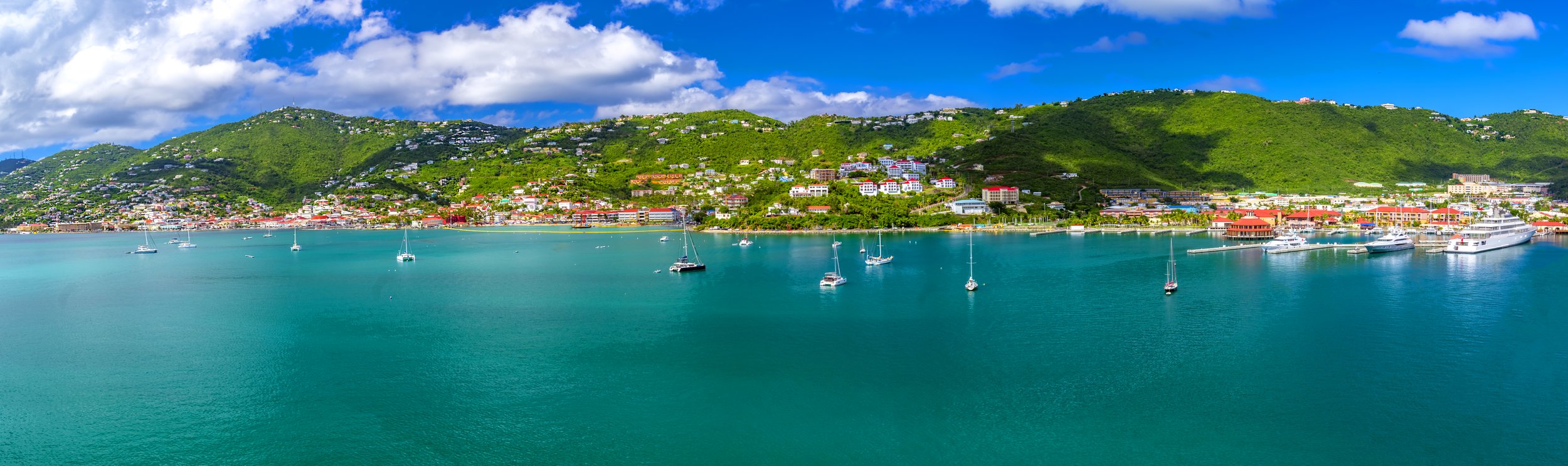
In St. Thomas building density varies greatly across the steep slopes and valleys of the island.
Although the very high winds during a hurricane are devastating, less than hurricane rated winds can cause considerable damage, especially when accompanied by heavy rains.
Although the very high winds that can be experienced during a hurricane are devastating, less than hurricane rated winds can cause considerable damage, especially when accompanied by heavy rains brought by tropical storms. The wind speeds required to topple trees that damage structures, vehicles and lead to power outages begin to occur far below hurricane speed winds (Table 2).
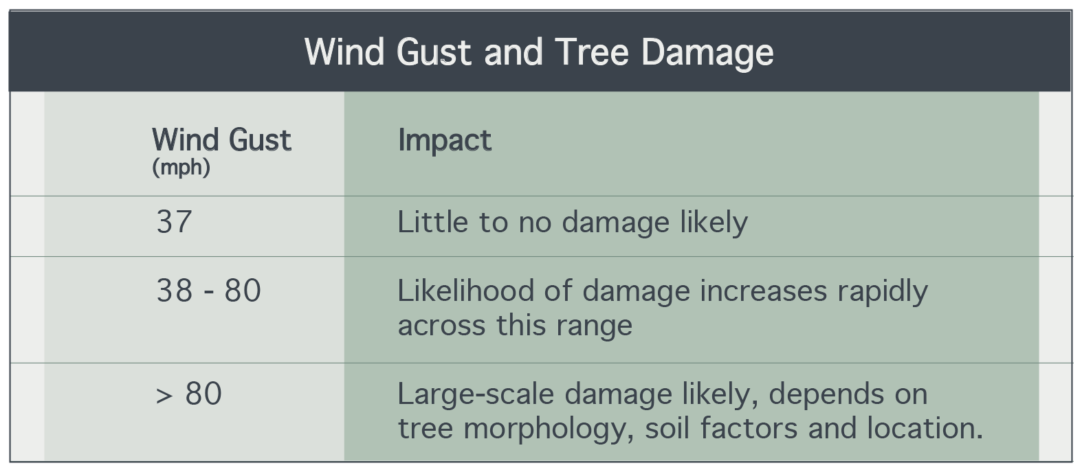
Table 2. Wind gust and tree damage scale.
Historical Occurrence
Although weather records beginning in 1850 provide a long-term measure of winds in storms over the past 170 years, the high wind speeds that occur during storms are challenging to accurately measure. Although techniques for measuring wind speeds in storms have changed considerably over the past 50 years with data from satellites and aircraft, it is still a challenge to obtain accurate wind speed measures in major hurricanes. The lack of accurate long-term records contributes to the challenge of definitively declaring that storm intensity and frequency have changed due to climate change. Table 3 shows recent hurricanes and recorded winds that occurred outside of storms and caused damage.

Table 3. Major wind events in recent records.

Hurricane Irma in 2017 caused extensive damage across the islands. Photo: Jarvon Stout
Hurricane Marilyn, September 1995
Hurricane Marilyn caused tremendous damage on St. Thomas, with most of it attributable to poor building practices and inadequate code enforcement rather than excessively high winds. There was significant, widespread damage to residences, commercial buildings, and critical facilities on St. Thomas, with nearly 75 percent of all buildings damaged. Approximately 21,000 homes were damaged or destroyed; 5,800 utility poles were damaged; the desalinization plant on St. Thomas was rendered inoperative; and repair of two sewage treatment plants was required (NOAA 1996). Damage occurred on St. Croix and St. John, but to a lesser extent. The most common type of damage was blow-off of the roof structure and/or roof covering.
The 2017 Hurricane Season

Hurricanes and tropical storms occur with such regularity on the Islands that they are steeped into many aspects of the culture. The destruction experienced during the storms listed in Table 3 followed by the rebirth or reconstruction is part of life in the islands. The 2017 hurricane season, however, from a historical perspective, was unique. In 2017 two category 5 hurricanes hit the Territory within 2 weeks causing major damage to both the USVI and Puerto Rico.
Hurricane Irma
Hurricane Irma originated as a tropical storm on August 30, 2017 off the west coast of Africa, approximately 420 miles west of the Cape Verde Islands. Over the course of the following week, the storm progressed westward across the Atlantic Ocean to the Caribbean just east of the Leeward Islands. By September 5, Irma had grown into a NOAA-rated Category 5 Hurricane. On September 6, Hurricane Irma passed near the USVI as a Category 5 storm, with a minimum pressure of 920 millibars (mb) (NOAA 2017a). Rainfall across the islands was estimated to be 4-10 inches from September 6-9, 2017 (NOAA 2017a).
Irma’s path cut through the northern portion of the three islands; the eye of the storm tracked through the British Virgin Islands, northeast of St. Thomas and St. John. Both St. Thomas and St. John were significantly impacted by high winds. At the time of landfall in the USVI, hurricane-force winds extended outward up to 50 miles from the eye, with tropical-storm-force winds extending up to 185 miles (NOAA 2017a). Estimated wind gusts reached approximately 150-160 miles per hour (mph) in St. Thomas and St. John. These speeds were determined from initial modeling using surface-level observations and observed storm pressures (3-second gust at 33 feet for flat, open terrain [ARA 2018])
Winds were generally strongest along the western and southern portions of St. Croix, where the storm passed by the closest. Estimated wind gusts up to 140 mph were determined from initial modeling of surface level observations and observed storm pressures (3-second gust at 33 feet for flat, open terrain, [ARA 2018]).
Hurricane Maria
Following close behind Irma, hurricane Maria brought wind gusts of approximately 150-160 mph on St. Thomas and St. John. Soon after, the outer eyewall of Hurricane Maria crossed St. Croix on September 20, 2017 and brought wind gusts of 137 mph at the Sandy Point National Wildlife Refuge on the southwest corner of St. Croix (NOAA 2017). Preliminary wind maps generated by ARA show the most severe wind speeds associated with Hurricane Maria striking the southwest corner of St. Croix, with wind speeds diminishing to the east of the island, and significantly lower wind speeds on St. Thomas and St. John).
What wind speed-up means for winds at my location
As previously described, wind speed forecasts for given locations can deviate considerably from the wind speeds you can expect at your location. The USVI together with the Structural Engineering Institute of the American Society of Civil Engineers conducted a wind speed study for the Territory. One product of this study is a map of estimated wind speed up for almost 40,000 locations across the Territory. This allowed us to calculate expected wind speeds for locations inland for given wind speeds at the shoreline. In summary, because of differences in topography, St. Croix (219 mph) , St. John (231 mph) and St. Thomas (240 mps) each had different maximum wind speeds and because of different patterns of development, each also has different exposure profiles to those expected wind speeds.
As per the 2019 US Virgin Islands Code Title 29 - Public Planning and Development Chapter 5 - Building Code, a basic wind speed of 145 mph is the minimum standard for the entire territory of the USVI.
St. John and St. Thomas have the highest percentage of structures in higher wind speed categories. For a shoreline wind speed of 138 mph, which represents a cat 4 storm. The top 20th percentile highest wind speed areas on St. Croix (175+ mph), St. John (184+ mph) and St. Thomas (192+ mph) includes 417, 437, 1411 buildings respectively, 5% (~900, 160) of the buildings on St. Thomas and St. John are subject to 200+ mph wind speeds for winds at the shoreline of 138 mph.
What This Means For The USVI
Damage from Winds
In addition to the dangers caused by flying debris, winds cause direct damage to susceptible features in the landscape including electrical power poles, roofs and trees. Wind-driven rain can also be a major source of damage to buildings, as it was during hurricanes, Irma and Maria. The fluid pressure of wind (how wind acts on an object or surface in its path) increases with the square of the velocity. This means that as wind speeds approach the upper level of a structure or objects rated wind speed or wind resilience (ex. tree, power transmission pole) even very small increases in wind speed have a multiplicative effect and can make a big difference in the damage sustained.
The good news is there are actions both government and individuals can take to minimize the impacts that high winds have on communities in the Territory. To assist the local building community it will be important to provide guidance to design professionals on how to use the new wind speed up maps and consider the higher wind speed criteria. Updated maps (those included in this report) should be considered for inclusion in the next edition of ASCE 7. Strict enforcement of building codes is another very important component of mitigating the potential impacts of high winds. Enforcing building codes is not enough if individual owners do not have the means to meet new strict standards, therefore public assistance programs that help those in need retrofit existing structures can make for good investment when the importance of safety and the costs of recovery are considered. Other structural changes include incorporating recommendations that emerge from ongoing work examining how to foster more resilient power delivery and communication systems in The Territory.
Individuals have an important role to play as well. Keeping the areas of their residences free from clutter can reduce damage and injury from flying debris. Properly disposing of trash (VI collection sites are notoriously littered with refuse, see Solid Waste Sector Analysis Section in this plan). Trees, which are important components of damage for the wind hazard, soil, health of the tree, spacing, and type are all important factors in determining if a tree will topple or break. Given that the VI is experiencing increased pressure from drought, tree health will suffer and lead to more trees toppling or breaking. Properly maintaining trees and shrubbery can help reduce loss during storms.